Although I’m a rabid mountain biker, I’m also a big fan of paved bike trails—the ones on which you don’t have to detail with vehicular traffic and risk your life dealing with distracted or angry drivers. I’ve hit the Ludlow Reservoir, the Norwottock Rail Trail, and the Columbia Greenway/Southwick rail trails. But, until recently, I had never heard of the Windsor Locks Canal State Park Trail.
How could I not have known about this historic canal and the path that runs alongside it? I think it’s the area’s best-kept secret. Even if you’re not into biking, it’s a beautiful walk as well. From Wilbraham, you can pretty much take back roads, jumping on I-91 for about 300 feet before getting on 190, crossing the river, taking a left on 159, and then another left on Canal Road in Suffield, CT. Just park at the end of Canal Road—the path is in white in the above map. You can take a left on the trail and double back to the 190 bridge, which has a separate, fenced-off bike path, for a great view of the river, but I usually save this part for last. So take a right and ride into history!
Right away you pedal over the ruins of a lock that once controlled water levels along the canal:
Here is an aerial view of it:
This is a 1909 photo of the lock. The buildings are long gone:
The canal was built by Irish immigrants between 1827 and 1829 so freight barges could avoid the Enfield rapids to Hartford. Indeed, the thing that struck me was how turbulent and shallow the river is along parts of this stretch. The 4.5 bike path is atop the old towpath, where oxen, mules, and horses pulled freight barges by rope. It is difficult to fathom 400 workers using just picks and shovels and removing the dirt and till with wheelbarrows: it is 80 feet wide and four-and-a-half feet deep.
So imagine a path that has water views on both sides (above). The Connecticut River on the left is blocked by trees at times, but there are also some great vistas, and that’s where you can check out the abundant bird life. I usually see 15 or more great blue herons every trip:
This one I spooked into flight, which is always something to behold. They look like pterodactyls when they take wing:
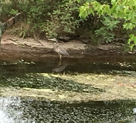
They’re usually in the river, but this one to the left was in the canal:
I also see the occasional white heron:
Okay, these aren’t sharp images, are they? An iPhone takes great photos, when subjects are far away, they tend to get blurry, as in the case of these two eagles on some rocks in the river. You can see their two bald heads. Or maybe you can’t:
Note to self: take a better camera next time. But how’s this for improvisation? I grabbed my binoculars and held one of the eyepieces up to the iPhone camera for a shot of another eagle. It’s still a blur, but not bad for a picture of a bird that was nearly on the other side of the river:
Still, I’m using SOMEONE ELSE’S eagle photos taken on the path to give you some idea of what you might encounter there:
Be forewarned: to protect nesting eagles, the southern end of the path is sometimes closed until the end of June by the State Department of Energy and Environmental Protection. Luckily, I went on these rides in August and September.
Moving south, here is the Stony Brook aqueduct about two miles down the path, where the canal is seen in the middle of the photo diverted OVER the stony brook (where the dark slot is below). It was built in 1927 and rebuilt in 1998.
Yes, that’s an homage to the runes of Led Zeppelin IV on the aqueduct.
Here is a 1960 illustration of the aqueduct. The structure is no longer there:
I’m not sure what the pulley structure did. This was when the canal was still open to boat traffic, as it was in this undated photo below, where they were undoubtedly recreating its towing days (you can see the rope). I think this was a part of one of the towns’ Bicentennial activities in 1976.
Now the only boats you’ll see in the canal are the occasional water chestnut harvesting to clean up the water a bit:
Further south the path goes under a railroad bridge that spans the canal and the Connecticut River.
More heavy metal tribute on the trail: this one the railroad bridge. My son took this photo of me worshipping Van Halen—and Satan.
This photo was taken in 1909.
Behold the good old red sandstone that is so prevalent in western Massachusetts (and I guess in northern Connecticut). You can also see some high sandstone cliffs across the river.
If you go there around sunset, you can see busy beavers swimming around:
I knew the iPhone photos would be underwhelming, so I took some video.
Farmland goods were hauled in the canal until the dawning of the railroad age in the 1840s made the canal freighting obsolete. But because it was 30 feet higher than the Connecticut River, for a while the canal’s water supplied mill power to factories.
As we approach the Windsor Locks end of the canal, I'll end this post here. Stay tuned for Part 2.


